


A severe weather outbreak which began in Texas and stretched through the Ohio Valley and Southeast, resulting in one death in Kentucky, persisted for a third consecutive day on Wednesday. The worst weather this time around occurred along the East Coast, particularly in parts of Virginia and Florida. Although atmospheric conditions were not as conducive for severe weather, the chances for damaging winds, large hail, and tornadoes were still present, though lower than on Monday and Tuesday. The risk level decreased from a Level 4 out of 5 to a 2 out of 5, prompting caution without letting up on preparedness.
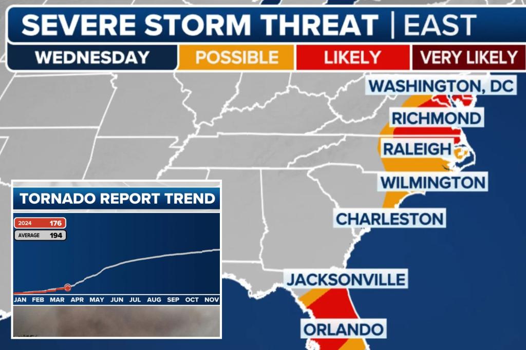
As the cold front moved past the East Coast, a significant amount of showers and thunderstorms continued ahead of it. The quick-moving storm system caused some storms to move east at speeds exceeding 50 mph, with several turning severe and prompting warnings for multiple counties. The majority of the storms were expected to move off the East Coast by sunset, but lingering winter weather on the northern end of the storm system was anticipated to continue through at least Thursday. A Tornado Watch was issued for the mid-Atlantic region, excluding Washington and Baltimore, with nearly 30 million people facing the risk of damaging wind gusts, large hail, and a tornado or two.
April is typically the second-busiest month for severe weather, seeing an increase in outbreaks as seasonal air masses clash over the eastern half of the country. It is often the second busiest month for tornadoes, following May. The presence of the global climate pattern El Niño tends to suppress severe weather outbreaks in the Lower 48, with the current year appearing to follow the norms established during previous El Niño events. Data from NOAA’s Storm Prediction Center indicates that tornado activity for the year is below average, while reports of hail and damaging winds are closer to average.
Overall, the severe weather outbreak that began in Texas and spread through the Ohio Valley and the Southeast caused significant damage and resulted in one fatality in Kentucky. This severe weather persisted for three days, with the worst conditions shifting to the East Coast, particularly in Virginia and Florida. Although the risk level for severe weather decreased, there were still chances of damaging winds, large hail, and tornadoes, prompting caution and preparedness. The storm continued to move along the East Coast, triggering thunderstorms and showers ahead of the cold front. The fast-moving storm system prompted severe storms, warnings, and a Tornado Watch for the mid-Atlantic region, putting nearly 30 million people at risk of severe weather.
April is typically a busy month for severe weather outbreaks, with increased activity as seasonal air masses collide over the eastern half of the country. El Niño, a global climate pattern, tends to suppress severe weather outbreaks in the Lower 48, with the current year following the trends of previous El Niño events. Data from NOAA’s Storm Prediction Center shows that tornado activity for the year is below average, while hail and damaging wind reports are closer to average. Despite the lower risk level, caution and preparedness remain essential in the face of severe weather threats. The storm system is forecasted to move off the East Coast by sunset, though lingering winter weather on the northern end of the system is expected to persist through at least Thursday.


