


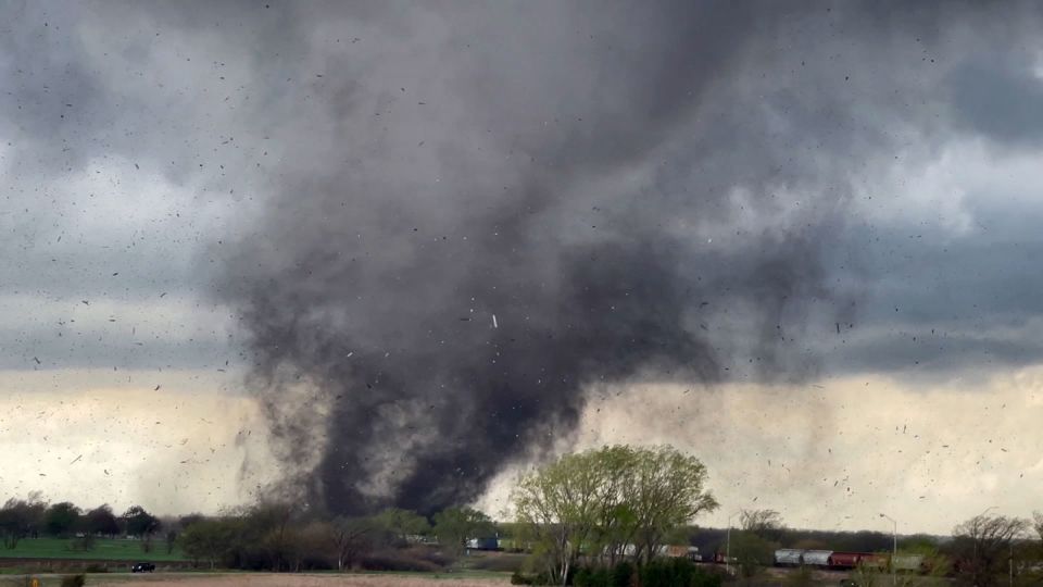
Devastating tornadoes tore across parts of eastern Nebraska and northeast Texas on a multi-day severe thunderstorm event that ramped up in the central United States. Storms began firing off across parts of the Plains and South early Friday afternoon, with multiple tornadoes observed in Nebraska and Texas. The National Weather Service issued a tornado emergency for the storm that tracked just to the west of Omaha. A tornado also roared through the outskirts of Lincoln, churning up debris and crossing part of I-80. Additional tornadoes were observed in Texas, including one northeast of Waco.
The tornado threat is expected to continue to increase through the evening as moist air from the Gulf of Mexico flows into the central US, priming the atmosphere for robust storms. Some locations are facing a severe thunderstorm threat spanning two or three consecutive days, with cities like Dallas, Kansas City, Des Moines, and Omaha at risk of multiple rounds of severe weather through Sunday. This is all part of a classic springtime setup for severe weather.
Friday saw severe thunderstorms bubbling to life in the Plains late in the morning, prompting tornado warnings in Texas. The Storm Prediction Center raised the severe risk in the region, with a Level 3 out of 5 risk in place in Nebraska, Iowa, Kansas, and Missouri. This risk area was later expanded south into Oklahoma, Arkansas, and Texas. The storms in Texas were expected to build in scope and strength throughout the afternoon and evening, reaching into Oklahoma and Arkansas. Damaging wind gusts, hail up to baseball size, and strong tornadoes were possible in the Level 3 risk area.
Saturday is expected to be the most dangerous day of the severe weather event if certain atmospheric conditions align. The potential strength of storms hinges on how Friday night’s storms evolve and linger into Saturday morning. The most significant storms are possible starting in the afternoon in parts of the southern and central Plains, with widespread damaging wind gusts, large hail, and strong tornadoes expected. Severe storms are possible outside of the greatest risk area in a large portion of the country from the Great Lakes to southern Texas. A significant rainfall event could unfold on Saturday, with some locations potentially seeing close to 5 inches of rain.
On Sunday, damaging storms are possible from Texas to Wisconsin, with the exact timing and extent dependent on how Saturday night’s storms behave. Areas from northeastern Texas to southern Iowa and western Illinois face the greatest chance for damaging storms, including the possibility of isolated tornadoes. Heavy, flooding rainfall is also possible in parts of the Lower Mississippi Valley. By Monday, severe weather is expected to become much more isolated, with any developing storms potentially confined to the Gulf Coast.


