


An Easter holiday storm system that initially brought Flash Flood Warnings to Los Angeles and heavy precipitation to California is now moving towards the nation’s heartland, with an area of low pressure developing in the central Plains. The storm is expected to bring severe weather, including damaging wind gusts, lightning, and tornadoes, to the middle of the U.S. before spreading eastward into areas like the Tennessee and Ohio valleys. Nearly 50 million Americans are at risk for severe weather on Monday, with widespread threats such as hail, wind damage, and tornadoes expected to impact parts of the Southern Plains and mid-Mississippi Valley.
In Oklahoma City, Tulsa, Norman, Springfield, Columbia, and other communities in Oklahoma and Missouri, there is a Level 3 out of 5 threat for severe weather, with the potential for large hail, damaging winds, and possibly nocturnal tornadoes. Additionally, on the northern side of the storm system, snow and freezing rain are possible in the north-central Plains, Upper Midwest, and Great Lakes region. The severe weather threat is expected to persist well into Monday night, increasing the risk of nighttime tornadoes, which are known to be more dangerous than those that occur during the day.
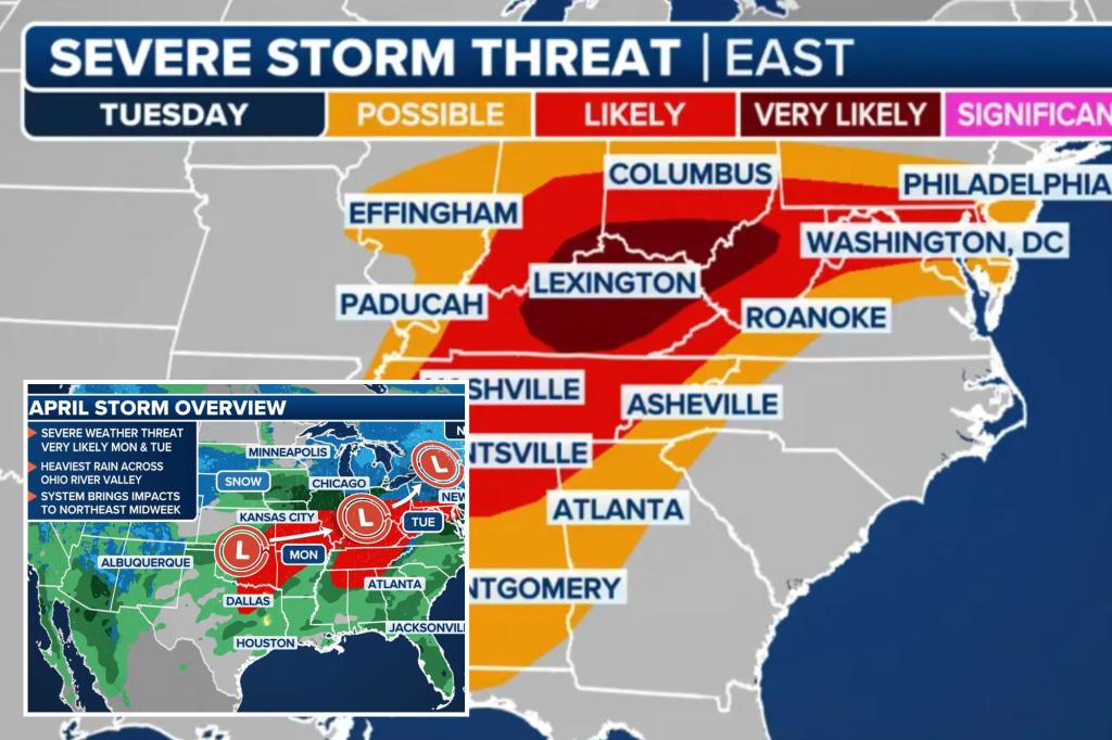
As the storm system moves eastward on Tuesday, areas such as Ohio, northern Mississippi, and Alabama are at risk for severe storms. The zone of heightened threat on Tuesday includes cities like Nashville, Tennessee, and Louisville, Kentucky, with the potential for all modes of severe weather. The FOX Forecast Center advises residents in these regions to stay alert and prepared for severe weather, as April typically sees an increase in severe weather outbreaks due to the clash of seasonal air masses over the eastern half of the country.
The unpredictability of severe weather outbreaks in April is influenced by various factors, including the El Niño-Southern Oscillation. Currently in a La Niña phase, the opposite of El Niño, the world is experiencing a period of increased severe weather activity. Although Tuesday’s threat zone may be more localized than Monday’s, residents are advised to remain vigilant and download the FOX Weather app for real-time alerts. Showers and thunderstorms are expected to persist until a frontal boundary exits the East Coast by Thursday.
Overall, the storm system that originated in the West is now affecting the central U.S., bringing with it the potential for severe weather, including tornadoes, hail, and damaging winds. Communities across the Southern Plains and mid-Mississippi Valley are at risk on Monday, while areas in Ohio, Alabama, and Tennessee face a heightened threat on Tuesday. As the storm system continues to move eastward, the threat of severe weather persists, highlighting the need for residents to remain prepared and alert during this period of increased severe weather activity.


