


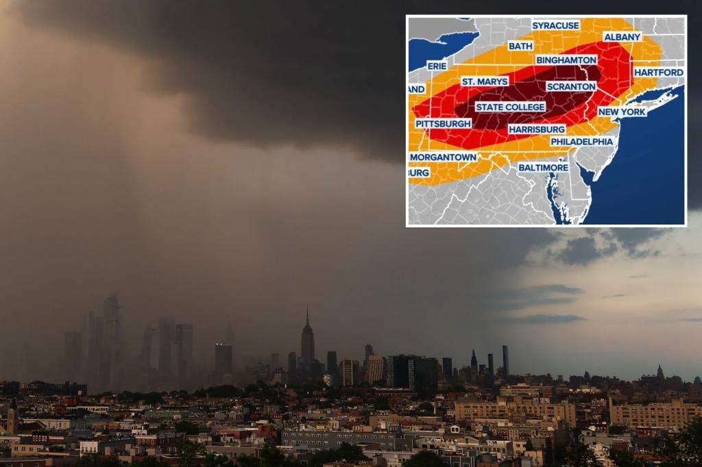
An approaching storm system from the Great Lakes region has the potential to bring showers and thunderstorms to the Northeast on Sunday. The FOX Forecast Center is anticipating thunderstorms to develop in the late morning and afternoon hours, moving from northwest to southeast across the area. The Storm Prediction Center has identified communities from eastern Ohio Valley through western Massachusetts as being at risk for strong to severe storms, with some cities like State College and Scranton falling under NOAA’s Level 3 out of 5 severe storm threat zone.
The primary hazard expected from these storms is damaging winds, but brief tornadoes and hail are also possible in the strongest storm cells. A total of approximately 34 million people are under the ‘possible’ threat zone, with 2 million in the ‘very likely’ region. However, the threat of damaging thunderstorms is expected to decrease significantly after sunset along the I-95 corridor, with cities like Philadelphia, New York, and Boston either on the edge or just outside the ‘possible’ threat zone for severe weather.
Depending on where the initial round of showers and thunderstorms develop, additional precipitation could impact areas in the eastern Ohio River Valley. While significant flash flooding is not expected, there are concerns about water levels along the Ohio River and its tributaries, with multiple water gauges already at flood stage. Any additional rainfall could exacerbate the situation and lead to localized flooding in areas that are already experiencing elevated water levels.
The possibility of severe weather on Sunday highlights the need for residents to stay informed about changing weather conditions and be prepared to take action if warnings are issued. It is important to have a way to receive weather alerts, whether through a weather radio, smartphone app, or other means, and to have a plan in place for how to respond in the event of severe weather. Keeping an eye on local forecasts and staying aware of any watches or warnings issued by the National Weather Service can help individuals and communities stay safe during potentially dangerous weather events.
As the storm system moves through the Northeast on Sunday, it is important for residents in affected areas to be cautious while traveling or spending time outdoors. Strong winds, hail, and lightning associated with thunderstorms can pose hazards to individuals and property, so it is advisable to seek shelter indoors during severe weather. By staying informed, being prepared, and taking appropriate safety precautions, residents can minimize the risks associated with severe weather events and protect themselves and their families from potential harm.


