


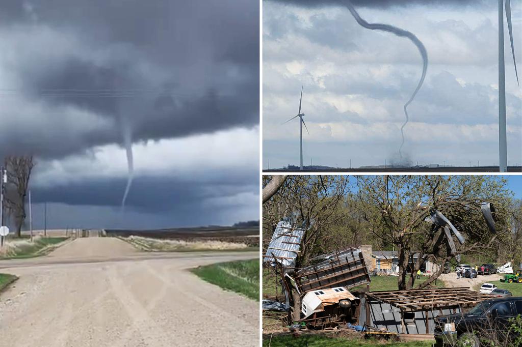
Severe weather across the Midwest triggered several Tornado Warnings on Tuesday, with several twisters captured on video in Kansas and southeastern Iowa. The Storm Prediction Center stated that atmospheric conditions were favorable for tornadoes, including a cone-shaped one in Iowa. This severe weather threat was the first of the year for Iowa, with damage reported in several communities including Mediapolis, Pleasant Grove, and Salem. Additionally, a commercial building was damaged in high winds in one of the areas.
In addition to the damage in Iowa, there were reports of homes being damaged in nearby New London, Iowa. An American Airlines flight bound from Kansas City to Chicago had to return to the airport due to a possible lightning strike. The flight landed safely in Kansas City, with all passengers being re-accommodated on alternate flights. Damage was reported in Clay County, Missouri, including a flipped mobile home and significant damage to a facility at Smithville Lake.
As the storms moved east, reports of damage and tornado sightings continued. In Osage County, south of Topeka, Kansas, several buildings were damaged by a tornado that was on the ground for 20 minutes. In Platte County, Nebraska, a tornado was sighted but did not touch down. Another tornado was confirmed in Dallas County, Iowa, with damage reported to an outbuilding and scattered sheet metal in fields. Power outages were also reported across several states, with Missouri having the highest number of outages.
Despite the severe weather, no significant damage was reported at the NWS office that services the Quad Cities as the tornado-warned thunderstorm approached. The responsibility for issuing warnings was briefly transferred to the NWS office in Des Moines before being handed back once the storm passed. The SPC received numerous reports of tornadoes, damaging winds, and hail from the event, with most reports coming from Missouri and Iowa.
Looking ahead, the severe weather threat is expected to shift east on Wednesday to the southern Great Lakes and the Ohio Valley. Scattered thunderstorms are possible in Michigan, Indiana, Ohio, Kentucky, and Tennessee. The SPC issued a Level 2 out of 5 risk for portions of Indiana, Ohio, and southern Michigan, with the potential for severe hazards such as hail, wind, heavy rain, and tornadoes. The storms are expected to begin in the afternoon and continue into the evening hours.


